dragonos: console tool: Auto137 NOAA Meteoroligal decoder over SDR!
In this so-cool article we go over the awesome NOAA Auto137 Tracking Application for decoding weather satellite data!

- This tool rocks in that it will automatically download various NOAA 15/ NOAA 18 / NOAA 19 / METEOR-M 2 data.
- You can modify the config.yaml and add as many satellites as it has decoder for from:
- It uses public known orbital prediction packages to get the TLE (Two Line Element) set for the four satellites (It is the mathematical vector to calculate a satellites location at any given point in time).
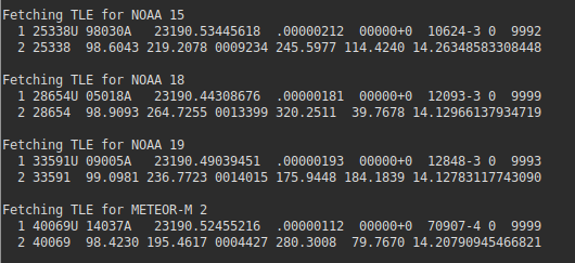
- The github for Auto137 is located here
Let's get started!
- Support Packages
Basically following the github guide in order for this tool to work you will need to download and install some other packages:
sudo apt install ffmpeg rtl-sdr python3-pip python3-numpy fpc build-essential
sudo pip3 install satellitetle orbit_predictor apscheduler pyyaml PyRSS2Gen
Once you have all the packages installed next it will want meteor_decoder from:
git clone https://github.com/artlav/meteor_decoder.git && cd meteor_decoder && sh ./build_medet.sh && sudo cp medet /usr/bin
git clone https://github.com/dbdexter-dev/meteor_demod.git && cd meteor_demod && make && sudo make install
2. Main Package Installation
git clone https://github.com/altillimity/Auto137.git
cd Auto137
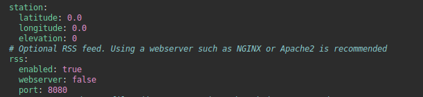
python3 main.pyNote: The Fun Stuff! You need to modify your config.yaml for your Lat/Long (Where is your base station!)
Once you update your latitude / longitude and run the application it will show you predict times:

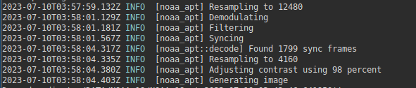
Summary: As understood it will automatically tune the receiver to the frequency of the passing satellite - when it comes by in order to capture whatever data would be sent.
Adding your Own Satellites
For instance the details for NOAA16 are located at the UN OSCAR tool:
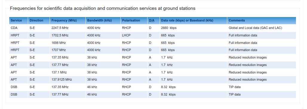
We can quickly see that NOAA16 has a APT at 137.35 / 137.77 / 137.1 and 137.9125 and its catalog NORAD reference is 23536. NOAA 16 actually no longer functions but this shows the process of adding your own satellite.
Adding NOAA 16 was as easy as adding this to the config.yaml
  - sat:
    name: NOAA 16
    norad: 23536
    priority: 1
    min_elevation: 10
    frequency: 137.35
    downlink: APT
    delete_processed_files: false
Once the flyby occurs a default automatic script will attempt to capture frames of images.
- It will conduct a 'raw download' of the RF spectrum in either .wav or .raw
- A scheduler will then process the raw into frame data if possible and construct an image.
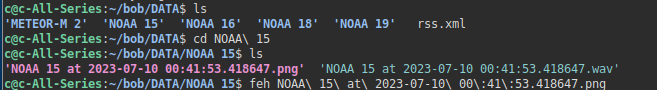
Images / wav files will sit in a directory inside the DATA as:
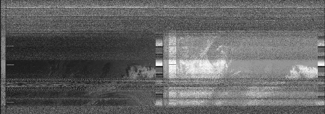
A typical image output:
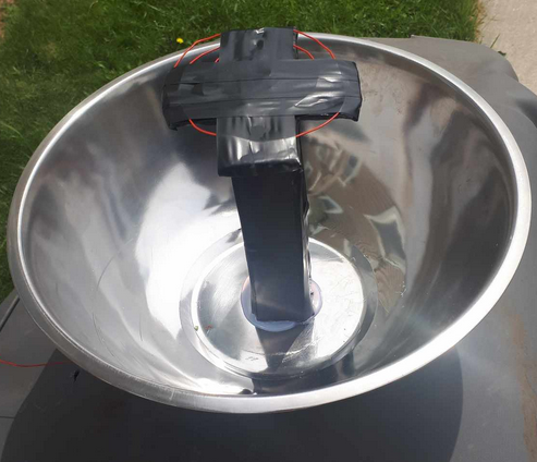
A small reflective bowl utilizing a fresnel type filament antenna roughly tuned to the capture frequencies worked. Running a single wire antenna was not found to be sufficient some directional type focusing antenna was required. A very small budget can do this with a simple glue gun and some time can have a working bowl catcher antenna:
- In real practice it does appear that these images are coming in over a very slow baud rate - and would take some time to receive. To remedy that one would require a two-axis tracker to maintain signal capture for a longer duration or the other option is to pick up data on the higher bandwidths. But to accomplish that would also require potentially a two-axis tracker as you would require higher gain for higher bandwidth. But POC (Proof-Of-Concept) did pass.
- There are other protocols such as DCP that have interesting text based information that could be captured over very small durations and would be perfect for these types of setups.